UN
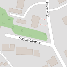
32 Imber Way
£ 197,500
Description
We don't have a Description for this property.
- Bedrooms
- 2
- Bathrooms
- 0
- Sqft
- 656.00

Leaflet © OpenStreetMap contributors
The heatmap indicates the level of crime in the area. The color of the heatmap indicates the crime severity and recency.
Metrics Year-on-Year
- Average area value
- 298,182.00 £Increased by 13.23 %
- Est sale value
- 211,232.00 £Increased by 2.55 %
- Average area rental value
- 1,058.00 £/moDecreased by 12.78 %
- Est letting value
- 656.00 £/moUnchanged by 0.00 %
- Est rental Yield
- 4.26 %Decreased by 22.97 %
- Crime Rate
- 2.00 %Unchanged by 0.00 %
from 263,333.00 £
from 205,984.00 £
from 1,213.00 £/mo
from 656.00 £/mo
from 5.53 %
from 2.00 %
Nearby Schools
| Name | Type | Ofsted | Distance |
|---|---|---|---|
| Sholing Sure Start Children'S Centre | Children's Centre | 0.60 KM | |
| Valentine Primary School | Community School | Requires improvement | 0.68 KM |
| Thornhill Primary School | Academy Converter | 0.80 KM | |
| Springwell School | Community Special School | Outstanding | 0.81 KM |
| Thornhill Sure Start Childrens Centre | Children's Centre | 0.93 KM |
Images
Nearby Streets
| Name | Average Price | Average Sqft | Distance |
|---|---|---|---|
| Butt's Crescent | £ 0 | 0 | 0.00 KM |
| Siddal Close | £ 216,667 | 0 | 0.00 KM |
| Butt's Close | £ 240,000 | 0 | 0.00 KM |
| Birch Lawn Close | £ 0 | 0 | 0.00 KM |
| Hayes Drive | £ 260,000 | 0 | 0.00 KM |
Nearby Transport
| Name | NLC | TLC | Distance |
|---|---|---|---|
| Sholing | 5930 | SHO | 2.42 KM |
| Netley | 5911 | NTL | 3.11 KM |
| Woolston | 5925 | WLS | 3.69 KM |
| Hamble | 5947 | HME | 3.85 KM |
| Bitterne | 5945 | BTE | 4.04 KM |
Nearby Listings
| Address | Price | Type | Score | Distance |
|---|---|---|---|---|
| Imber Way, Sholing, Southampton, SO19 | £ 375,000 | BUY | 7 / 10 | 0.00 KM |
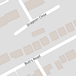
| Dragoon Close, Southampton, SO19 | £ 240,000 | BUY | 7 / 10 | 0.06 KM |
| Dragoon Close, Sholing, SO19 | £ 260,000 | BUY | 6 / 10 | 0.07 KM |
| Dragoon Close | £ 250,000 | BUY | 7 / 10 | 0.07 KM |
| Dragoon Close, Southampton, SO19 1SH | £ 225,000 | BUY | 7 / 10 | 0.07 KM |
Nearby Properties
| Address | Price | Distance |
|---|---|---|
| 32 Imber Way | £ 197,500 | 0.00 KM |
| 22 Imber Way | £ 230,000 | 0.00 KM |
| 5 Imber Way | £ 162,000 | 0.00 KM |
| 3 Imber Way | £ 123,000 | 0.00 KM |
| 48 Imber Way | £ 250,000 | 0.00 KM |